

On our first day at Kessingland caravan park we squandered the time away at the swimming pool, the beach and took a short walk into the village. By day two we were ready to explore and so we set off for nearby Southwold.
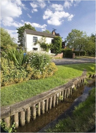
Southwold is ridiculously picturesque and quintessentially English, a town of Tudor houses and thatched roofs, so English that it is high on the list of filming locations for English film and television.
The fictional Southwold Estate, seat of Earls of Southwold, is the country estate of the family of Lady Marjorie Bellamy in the drama Upstairs, Downstairs and the town and its vicinity has been used as the setting for numerous films and television programmes including Iris about the life of Iris Murdoch starring Dame Judy Dench, Drowning by Numbers by Peter Greenaway, Kavanagh QC starring John Thaw, East of Ipswich by Michael Palin, Little Britain with Matt Lucas and David Walliam, a 1969 version of David Copperfield and the BBC children’s series Grandpa in My Pocket.

We parked the car and walked along the short seafront, a pebbled beach that is difficult to walk upon, a promenade and a row of gaily painted beach huts. Next we came to the pier. The pleasure pier is characteristically English, a genuine icon and one that I have never really understood.
No one in England lives more than seventy miles* or so from the sea but when they get to the coast they have a curious compulsion to get even closer to the water and as far away from the shore as possible without taking to a boat. The Victorians especially liked piers and by time of the First-World-War there were nearly two hundred sticking out all around the coastline. If there had been satellite photography a hundred years ago then England would have looked like a giant pin-cushion.
It is a very nice pier with shops and amusements all the way down to the end. In 2002 it was voted ‘Pier of the Year’ by the UK National Piers Society, it is quite short at only just over two hundred yards, when it was built in 1900 it was seventy yards longer but it has suffered various damage over the years.

English piers you see are rather fragile structures and over the years have had an alarming tendency to catch fire – Weston-Super-Mare, Brighton, Blackpool, Eastbourne, and Great Yarmouth have all suffered this fate but Southend-on-Sea is probably the most unfortunate of all because it has burned down four times which seems rather careless.
The problem with a pier of course is that they are generally constructed of wood and are highly combustible and a quarter of a mile or so out to sea they are also rather inaccessible to the fire service so once they go up in flames little can be done but to watch the blazing inferno from the safety of the promenade until the fire goes out by itself and all that is left is a tangle of twisted metal girders and beams.
Fire isn’t the only danger of course because the coast can be a rough old place to be in bad weather and severe storms and gales have accounted over the years for Aberystwyth, Cromer, Saltburn and Brighton. Reaching far out to sea also makes them rather vulnerable to passing ships and the aforementioned unfortunate Southend-on-Sea was sliced in half in 1986 by a tanker that had lost its navigational bearings. One unfortunate man was in the pier toilets at the time and apparently only just made it out in time before they tipped over the edge!
There isn’t much else to say about Southwold except that George Orwell once lived there and so after only a short stop and a drive around the busy streets we continued our drive planning to stop next at the Suffolk port town of Lowestoft.
I didn’t find Lowestoft that thrilling I have to confess, it looked much like Grimsby to me where I live, a run-down sort of a place urgently in need of some investment and a make-over but there was one especially interesting place to visit while we here – Ness Point, the most easterly place in the British Isles.

For such a significant place I would have expected it to be something special, a bit like Four Corners in the USA but not a bit of it.
There is no visitor centre and no souvenir shop, just a windswept carpark and it is difficult to find located as it is on the edge of an industrial estate and close to a sewage treatment works and a massive wind turbine called Goliath (it was once the biggest in England). There is only a circular direction marker known as Euroscope, marking locations in other countries and how far away they are. I felt like an explorer about to set sail.
The ‘Visit Lowestoft’ web site proclaims that, “No trip to Lowestoft is complete without a visit to Ness Point, the most easterly spot in the United Kingdom” As far as I could see this is about the only reason to visit Lowestoft so with nothing to detain us longer we headed directly back now to the seafront car park and enjoyed an especially good meal of fish and chips.
I was reminded that a couple of years ago I was at the most Westerly point in the British Isles** on the Dingle Peninsular in Southern Ireland where we were staring out at two thousand miles of water and next stop Canada and the USA.
The Blasket Islands (10°39’) at the end of the Dingle Peninsula are the most westerly point in the British Isles but these have been uninhabited since 1953, Iceland is the most westerly country in Europe and Reykjavik is the most westerly capital city (21°93’); Lisbon (9°14’) is the most westerly city on mainland Europe and furthest west than anywhere else are the Azores at 31°30.
When someone tells you that something is the biggest or the longest or the highest or the heaviest it is always worth checking up I find. The most westerly point in Asia is Cape Baba in Turkey and in the United States it is Alaska which is also the most easterly as well because it stretches so far that it crosses right into the eastern hemisphere (a good pub quiz question that).
The day ended with an especially fine sunset…

* Based on a direct line drawn on an Ordnance Survey map from location to the first coast with tidal water. The village that is further from the sea than any other human settlement in the UK is Coton in the Elms in Derbyshire at exactly seventy miles in all directions…
** The British Isles are an archipelago in the North Atlantic Ocean that consists of the islands of Great Britain, Ireland, the Isle of Man and over six thousand smaller isles. The term ‘British Isles’ is controversial in Ireland where there are nationalist objections to its usage and the Government of Ireland does not officially recognise the term and discourages its use.
Click on an image to scroll through the gallery…


So if it costs £1 to see Punch and Judy, what happens if you are just walking along the jetty and your eye wanders and you see it. Can you stop or does Punch whack you?
LikeLiked by 1 person
Wear sunglasses and don’t look directly at the show!
LikeLike
Lowestoft and Great Yarmouth are good places to see the relatively rare Mediterranean Gull. Not many people know that.
LikeLiked by 1 person
I didn’t know that. Thanks for the information!
LikeLike
Well, you certainly find your facts about a place, Andrew!
LikeLiked by 1 person
Google is my middle name!
LikeLiked by 1 person
Of course! If you are AGP…Any Google Possible
LikeLiked by 1 person
You really think England has few peers?
. . . oh . . . piers . . . nevermine.
Those look like nice places to visit.
LikeLike
We have a lot more peers than piers, we can’t seem to get rid of them!
LikeLike
Informative post and fine gallery. Good to see you got some stretching in
LikeLiked by 1 person
The mirrors were a lot of fun, thanks Derrick.
LikeLiked by 1 person
Tearaght Island, off the Dingle Peninsula, at 10° 39.7′ is the westernmost of the Blaskets. and was inhabited until 1986 when the lighthouse was automated.
LikeLike
Thanks for adding that fact Michael.
LikeLike
Glorious sunset! Don’t think I made it to Southwold 😕
LikeLike
A bit of an effort to get there from the North East Jo!
LikeLiked by 1 person
I seem to remember the soufen pier was a mile long and ‘ad a train service. Loved the Kursaal when I was a billy
LikeLike
Claims to be longest pier in the World. Busleton Jetty in Australia gets close!
LikeLike
I’ve been to Busselton in WA but can’t recall a pier, I was probably drunk at the time. I’ve checked it out on the web and it’s the longest in the world 2 km,
Baudin the French explorer was the first to get to that area and named the bay on where the town was later founded, Geographe Bay after his ship, He also named another spot in WA after the other ship which sailed in company with Le Geographe, Cape Naturaliste, the French spelling was kept, wisely I feel. The area was settled by a family by the name of Bussell.
LikeLike
Thanks for the additional information!
LikeLike
Lovely. Just happens that we recently hit the farthest Western edge of our lower 48 states at Flattery Point. I hope to get around to posting it one of these days. In the meantime, you mentioned ‘Kavanagh’… I don’t suppose you follow our news to understand what a rotten name that seems to be over here these days! 😀 The Guardian did a fairly decent job of describing the debacle in an opinion piece by Richard Wollf.
LikeLike
Just when you think you have reached the bottom of Trump’s cesspit it gets even deeper!
LikeLiked by 1 person
Hard to believe we’ve come to this! 😠
LikeLiked by 1 person
Pingback: Thursday Doors – English Beach Huts | Have Bag, Will Travel
I was living in Southsea in 1974 when the pier burnt down – Ken Russell was filming there at the time – and the sense of loss and of anger from everyone, me included, and I was a newbie in town, was extreme. We’re hard-wired to need piers at the seaside I think. Beach huts are a delightful optional extra.
LikeLike
Enjoyed gaining more knowledge, both from your interesting post and from some of the comments.
LikeLike
Thanks Sue!
LikeLike
Southwold is our nearest beach so we visit it quite often; especially during the winter when it isn’t so crowded. It does have quite a bit of sand beyond the shingle; you must have visited when the tide was in. Poor old Lowestoft is definitely in need of some help, though it has had a makeover recently. You should have seen it before! 😀
LikeLike
It is a nice seaside town.
A shame about Lowestoft. I live near Cleethorpes which is similar in its decline.
LikeLiked by 1 person
Lowestoft is wonderful when compared with Great Yarmouth!
LikeLiked by 1 person