From the village of Donington and the birthplace of Matthew Flinders we travelled east towards the coast and the North Sea.
This area was once marsh and fen but has been successfully reclaimed from the water to turn it into a highly productive arable farming industry. Driving on the roads takes great care and undivided attention because it isn’t so difficult to slip off the tarmac and into one of the roadside drainage ditches. People who move to the area to live are only ever really accepted into the community after they have paid a visit to the bottom of a ditch and become a member of The Fens ‘Dyke Club’.
This was an area of wetland for two reasons, first it is barely at sea level and high tides would swamp the land and secondly because four major rivers flow into The Wash, The Witham, The Welland, The Nene and the Great Ouse, all of which drain the English Midlands into the sea. At times when there was too much water there was inevitable flooding. The East Coast Fens are simply former marshland. This was a place where you almost always needed to wear wellington boots.
The Romans came to The Fens and built the first sea defence wall about ten miles inland and which stretched for thirty miles or so. It is still called the Roman Bank. Beyond the Bank they maintained salt pans.
For several hundred years a battle was fought to reclaim land from the sea and the prize was access to very valuable fertile farming land. Several walls and enclosures were built in the late nineteenth century and many thousands of acres reclaimed for farming. During the Second World-War Britain was short of food so more farming land was required so at about this time the final and present sea wall was built to provide even more arable farming land to feed the nation. It is doubtful that they will ever build another one because with modern methods of farming there is enough land now for the time being.
After leaving the A17 and driving north there are miles and miles of absolutely bugger all. A couple of small villages, some isolated farm workers cottages and modern industrial scale farms where there is rarely any sign of life. It is a ‘Slaughtered Lamb’ sort of place where local people look at strangers with suspicion and wonder if they are not driving a mud caked Land Rover or a Massey Ferguson Tractor pulling a plough just what they are doing there.
This is a remote place without visitors. There are no tourist signposts and I wasn’t sure after ten years away if I could confidently remember exactly how to reach the place that I was trying to get to. With the help of the SatNav (working again now) a huge slice of luck and a fading memory I found the road/track that leads to the sea wall and we made it to our destination. A narrow pot-holed track and not the sort of lane that you want to meet mud caked Land Rover or a Massey Ferguson Tractor pulling a plough coming in the opposite direction!
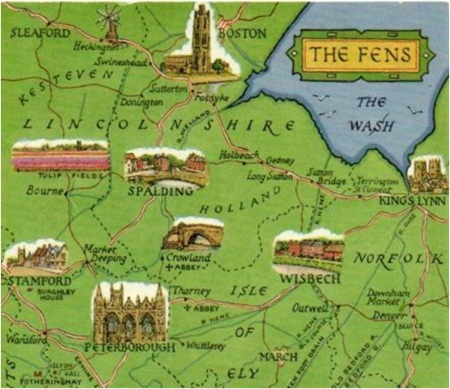
The orange arrow indicates approximately where we were…
… just farm fields at the edge of the World before the marshes and as close to the sea as you can get without wellington boots.
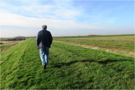
This part of Lincolnshire can be inhospitable and bleak but on a blue sky day like today it is absolutely magnificent. We parked the car and climbed to the top of the wall, not a brick or concrete structure but a stout earth wall decorated with concrete Second-World-War defence bunkers. To the north-east we looked out over the marshes and the North Sea and behind us we stared out over acres and acres of patchwork farm land just waiting to leap into Spring.
John and I walked along the wall and swapped tales and stories from our lives separated by fifteen thousand miles or so geographically but what seemed to me now only as thin as a cigarette paper.
It occurred to me that John lives so far away in Australia and a thousand years or so ago someone may have stood in this exact place (in his wellington boots of course) and thought that it must surely be the edge of the World. Travel and friendship is so important in personal development and exploration and education.
On the way back we drove through the village of Moulton which has the tallest windmill in England (this part of Lincolnshire is full of surprises) and then to Cowbit, John thought it was a strange name and I told him that it is not pronounced how it looks on the sign but as ‘Cubit’. Friendly sparring now, John told me that Melbourne is not pronounced in the same plummy way as Lord Melbourne but as ‘Melbun’.
It had been a very enjoyable and satisfying day.
Click on an image to scroll through the Gallery…
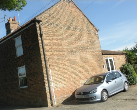
Almost forgot to mention that this is where I lived in The Fens for ten years, 2000-2010…
Kim joined us and we spent a convivial time in the bar, drank more than we planned to and had an enjoyable evening meal. I saw John again in the morning as he prepared to return home to Melbun in Australia…
You can follow John’s Blog at https://wordpress.com/read/feeds/95569324


You’re quite the tour guide. Guess we’ll have to come visit. 🙂
LikeLike
You would be most welcome on one of my tours Peggy!
LikeLike
You made John’s limted time truly memorable.
LikeLike
I hope so Sheree. Thanks.
LikeLiked by 1 person
So good to have a tour well away from all the tourist haunts and have the chance simply to be together as well.
LikeLike
Even without mountains! It is not a busy area with tourists.
LikeLike
I used to birdwatch a lot at Freiston Shore north of Boston, walking south as far as North Sea Camp. That was very bleak too, although lots of birds.
LikeLike
John kept announcing bird sightings as we drove but it was too dangerous to take eyes off the road.
LikeLike
I hope you didn’t mind me using your orange arrow?
LikeLike
Well, that all worked out very nicely 🙂 🙂 Definitely end of the world stuff! I’d best pop over to Melbun and meet John.
LikeLike
Try catching his blog, you might enjoy it!
LikeLike
Just been chatting to John/Paol 🙂 🙂
LikeLiked by 1 person
That is two good friends connected then!
LikeLike
🤗💕
LikeLike
I am a tour guide and an introduction agency!
LikeLiked by 1 person
So well described, Andrew. I assume all those right angles in the dark leading people into the ditches are the reason for the “Dyke Club”.
LikeLike
Honestly Derrick it is so easy to slide off the road and those ditches are deep. Do it at night in the dark and you are in real trouble.
LikeLiked by 1 person
I used to do some consultancy in Spalding, and saw a few in the ditches.
LikeLike
Luckily I have never visited the bottom of a drainage ditch! Thanks Derrick.
LikeLiked by 1 person
Most interesting…and I’m with you on “Travel and friendship is so important in personal development “, Andrew
LikeLike
Thanks Sue!
LikeLiked by 1 person
Parts of the fens were drained by Cornelius Vermuyden – he also drained the flat lands between Scunthorpe and Goole, partly by altering the course of the River Don.
LikeLike
Thanks for the additional information.
This sentence in Wiki caught my eye…
“The work on Hatfield Chase was only partially successful: the straightening of the river Don and outlet into the Aire caused flooding in Fishlake”. I think Fishlake flooded only last year?
LikeLike
“there are miles and miles of absolutely bugger all.” Not sure what this means, Andrew, but I am assuming it’s bad.So you lived 10 years in the fens. Did you earn your membership in the Fen’s ‘Dyke Club?’ –Curt
LikeLiked by 1 person
No, not bad just miles and miles of farmland and then the marsh and then the sea. Not many places in England that you can find as empty and lonely as this.
I was lucky never to join that particular club Curt.
LikeLike
I tend to find ’empty and lonely’ good. Glad you didn’t end up in the ditch, Andrew. That looked like a serious hole in the ground! –Curt
LikeLiked by 1 person
Loved the comment from Curt, I just take it for granted that everyone understands our English expressions, I wonder what he would have made of Sod all! I agree with the others, you are a fantastic tour guide, and I enjoyed reading about the trip.
LikeLike
I thought ‘bugger all’ was fairly universal.
Thanks for coming along on the trip.
LikeLiked by 1 person
My Pleasure.
LikeLike